Reaches · April 2026
The flat counties south of the state line
Fifty miles of ground with nothing on it above eye level, where weather is visible an hour before it arrives.
- Where
- Flat country counties, south of the line
- Water
- Not applicable, inland
- On foot
- Mostly driving, short walks
- Written by
- Hollis Mabry
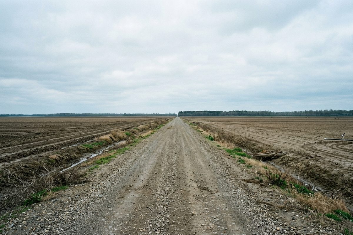
Drive an hour south from the city and the last hill disappears. What replaces it is fifty miles of alluvial plain so flat that the only vertical objects are grain bins, water towers and the levee itself.
The temptation is to call it empty. It is not empty, it is agricultural and heavily worked, but it is unusually free of things that stick up, and that changes what the light does.
Why the light is different here
Because the horizon is genuinely at eye level in every direction, the sky occupies far more of the visual field than it does anywhere with terrain. Sunrise and sunset last longer in the sense that matters: the low angle light travels across open ground instead of being cut off by a ridge.
The practical result is that the good hour is nearer two hours, and that weather is visible from an enormous distance. A thunderstorm forty miles away is a complete, legible object: anvil, base, rain shaft, the lot. On higher ground you would see the top of it and nothing else.
The levee as a road
The levee runs for the length of this country, and much of its crown is a gravel road that is legally passable in many stretches and closed in others.
Driving it is the single best way to see the flat country, because it is the only elevated line available. Twenty feet of height is enough to see over the crops and to look down on both sides at once: fields on the land side, willows and batture on the river side.
What is worth stopping for
The batture, meaning the ground between the levee and the river. It floods most years, so it is willow, silt and driftwood rather than crops, and it is the wildest ground in that flat country.
Grain infrastructure at scale. Elevators here are enormous and photograph as pure geometry against flat ground.
Crossroads with nothing at them. The road pattern is a survey grid, so intersections occur every mile whether anything is there or not, and most of them have nothing.
Season and light
Spring, before the crops are tall, when the fields are bare and the geometry is at its clearest. Late autumn, after harvest, for the same reason with warmer light.
Midsummer is cotton and soybeans at full height, which closes the view down considerably, and it is extremely hot with no shade anywhere.
Practical
This is a driving trip with short walks, not a walking trip. Distances are large, fuel stops are sparse, and phone coverage is patchy between towns.
Nothing here floods in the way the bottomland forest does, because that is what the levee is for. What does happen is that the batture side goes under regularly, so anything described on the river side of the levee is stage dependent.
Nothing on this page is sold, and no fee was taken for any place named on it.