Reaches · March 2026
Bottomland forest north of the city, in high water
A hardwood forest that spends part of every year underwater, which is precisely why it is still standing.
- Where
- Bottomland forest, north of Memphis
- Water
- 29.4 ft, rising
- On foot
- Four miles, wet, boots
- Written by
- Hollis Mabry
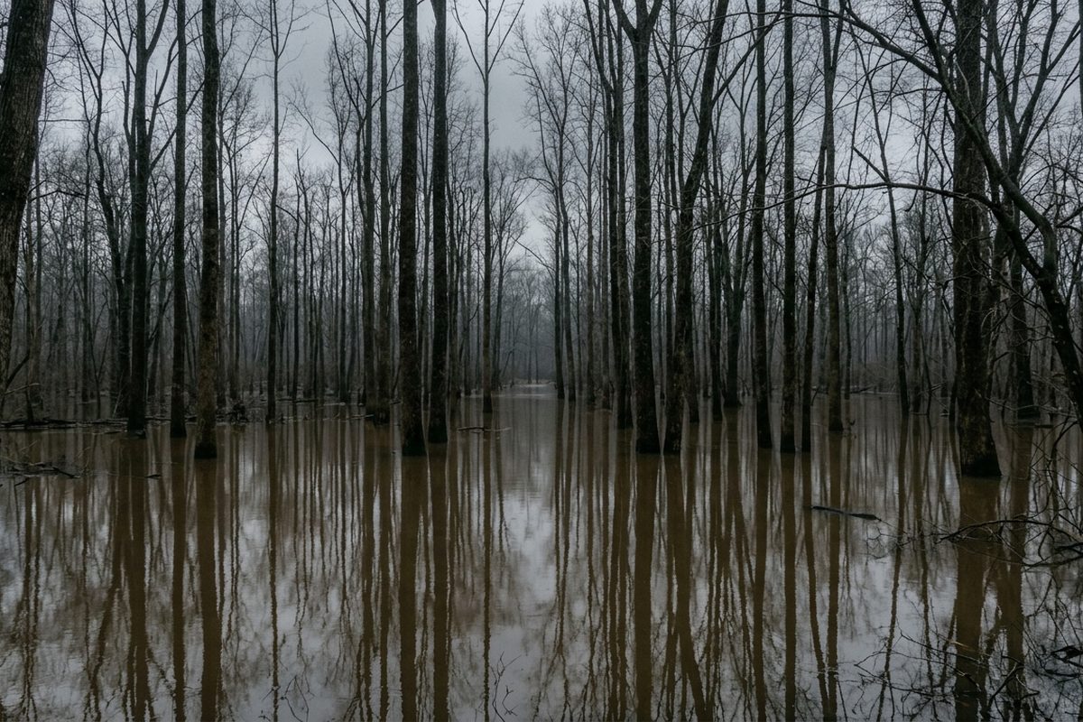
The forest north of the city floods on purpose. Not by accident and not because of failure: the whole system of bottomland hardwood along this river evolved to be underwater for weeks at a time, and the reason this piece of it survives is that nobody could farm it.
At twenty nine feet the water comes up through the ground rather than over a bank. Backwater fills the low ground first, then the sloughs, then the trail, and it does it so slowly that you can stand still and not see it happen.
What it looks like
Straight grey trunks standing in still brown water, repeated until the light gives out. No undergrowth, because the flooding kills anything that cannot survive submersion, so you can see two hundred yards through the trees in a way that no dry forest allows.
The water is perfectly still. Every trunk is doubled. There is no wind down there because the canopy stops it, and the silence is total apart from woodpeckers, which sound enormous.
This is the one landscape in the region that improves as it becomes impassable.
The problem, stated clearly
You cannot walk in it. That is the point of this piece.
At this stage the trails are under one to three feet of water, and the ground beneath is soft silt with holes in it. Wading looks trivial and is not: the surface gives no indication of depth, the bottom is uneven, and the water is cold in March.
What works is walking the ridge trails, which stay dry a few feet above the flood, and looking down into the forest from them. There are several, they are marked, and they are the reason this trip is possible at all.
The two weeks worth planning for
Late February to late March in most years, on a rising or just cresting stage between twenty five and thirty two feet.
Below twenty five, the water is in the sloughs but not among the trunks, and the effect is much weaker. Above thirty four the access roads themselves start closing and the answer is to stay home.
That window moves by weeks between years and it cannot be booked in advance. Watching the gauge for a fortnight and going on two days' notice is the only way to catch it.
Light and season
Overcast is better than sun. Direct light on still water in a bare forest produces contrast that nothing can hold, while flat grey light gives the trunks their separation and keeps the reflections readable.
Bare trees matter as much as water. By late April the canopy closes, the light on the floor drops to almost nothing, and the same flood photographs as a green mess.
Practical
Boots that you accept will be ruined, or waders if you own them. Insect conditions are mild in March and become serious by May. There is no phone signal for most of the area.
Tell somebody your route. This is the single piece of ground in this paper where that instruction is not a formality.
Nothing on this page is sold, and no fee was taken for any place named on it.